
Above and Beyond Rest Stops
The Natchez Trace Parkway is more than 400 miles long and passes through three states. While most people go through the major cities, you will also get the opportunity to see some fascinating stops along the way.
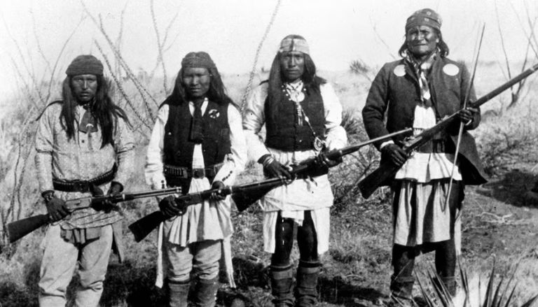
Each of these will establish a connection between you and the Trace’s triple legacy, which includes nineteenth-century frontier battles, engineering during the Great Depression, and ancient Indigenous traditions.
(Milepost 10.3) Emerald Mound is located.
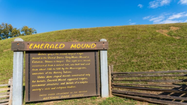
This enormous pre-Columbian earthwork can be found just ten kilometers into your journey towards your destination.
Second only to Cahokia’s Monk’s Mound in terms of size, this Mississippian mound is the second largest in North America. It was constructed between the years 1250 and 1730 CE, and the builders used only woven baskets to move an amazing 35,000 cubic yards of soil in order to create this 8-acre summit that stands 35 feet tall.
There is a trail that encircle the base that is 0.3 miles long and has signage that describe how it correlates with solstice occurrences. You can take a stroll along this trail.
Located at milepost 15.5, Mount Locust
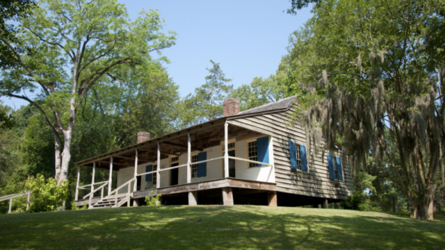
During the 1820s, when the Trace was at the height of its popularity, this is one of just two “stands” (inns) that have survived. In the past, enslaved servants such as Rachel, who worked as a cook, were responsible for serving corn mush to “Kaintucks,” who were boatmen who paid 25 cents for a whole night’s stay.
The original floorboards are still present, and there is a slave cabin that has been recreated for your viewing pleasure. Participating in a ranger program will allow you to witness demonstrations of open-hearth cooking and cotton processing. Spend some time exploring the slave cemetery and paying a visit to the 43 graves that are unmarked.
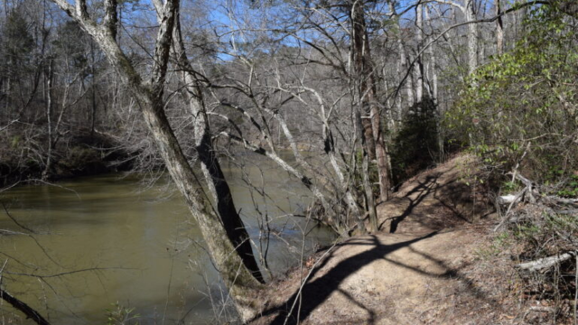
(Milepost 41.5) The Sunken Trace trail
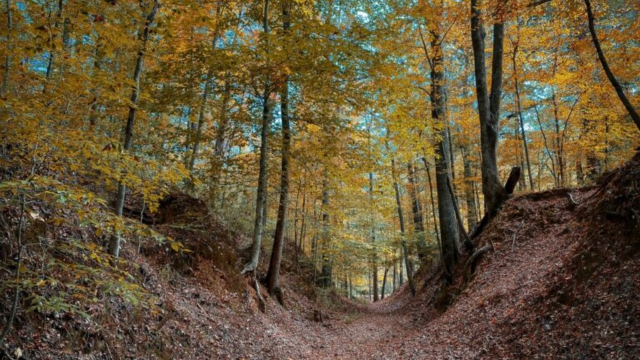
The reason that early travelers referred to the Trace as “the Devil’s Backbone” is demonstrated well by this 200-yard piece that has been maintained.
Over the course of several centuries, foot activity has carved out a natural trench that is around ten to fifteen feet deep. This trench is so narrow that horsemen in the 19th century had to guide their horses through it in single file.
Sunlight is filtered onto the walk by moss-covered oaks, which helps to keep the path cool even throughout the summer. Take a look at the exhibit by the wayside to learn about how Choctaw guides contributed to the expansion of the trail in 1801 for military use.
Situated at Milepost 122.0, Cypress Swamp
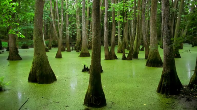
Can’t stand the oppressive heat of the Mississippi summer? You can walk through this flooded forest of water tupelo and bald cypress by taking the boardwalk that is 0.4 miles long.
The swamp that was developed in an old channel of the Pearl River, and those strange sculptures that are protruding from the water that has a tea-colored color? They are root protrusions known as “knees” of cypress trees. Keep an eye out for newborn alligators sitting on logs and barred owls hanging out in hollow trunks. Both of these animals can be seen in the area.
According to Milepost 286.7, Pharr Mounds
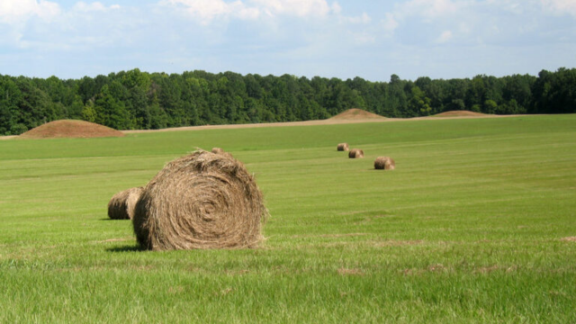
Despite the fact that most people quickly pass by these eight grassy mounds, you are currently observing the Parkway’s earliest environment that was created by humans. An astonishing account of ancient trade networks may be found in these burial mounds, which were constructed by the Miller Culture between the years 1 and 200 CE.
In addition to containing cremated remains, the tallest one, which stands at a height of 18 feet, also contains copper artifacts that had traveled up to 2,000 miles (from the Great Lakes to the Gulf Coast!).
In order to witness something truly remarkable during the spring equinox, when the dawn is perfectly aligned with Mound E, you should park your vehicle at the overlook. It’s even possible that you’ll see cattle grazing locally.
Located at milepost 266.0, the Parkway Visitor Center
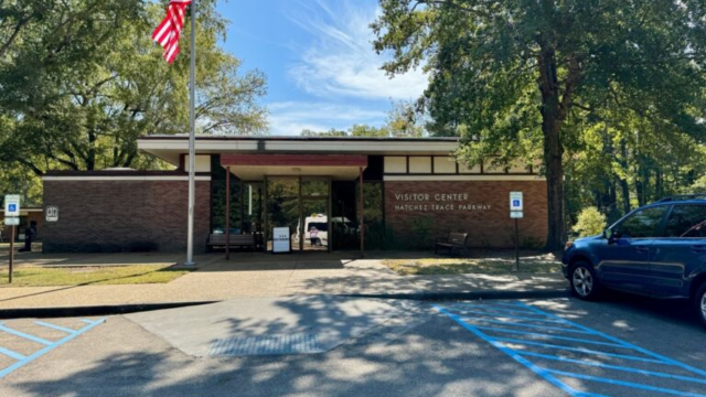
It is not enough to simply take a map and leave when you get at this station. This National Park Service hub is located close to Tupelo and covers a span of 10,000 years of history, ranging from Paleo-Indian implements to the creation of the Parkway in the 1930s.
Through the use of interactive exhibits, you will be transported from Paleo-Indian spear points to road crews from the 1930s Civilian Conservation Corps. After watching the twenty-minute film that features drone footage of locations along your path, you will have the opportunity to talk to rangers about recent sightings of black bears.
The recreation of a dugout canoe measuring forty feet in length demonstrates how merchants transported their wares to New Orleans in the past. Please make a trip to the bookstore before you depart. Rare titles such as “The Devil’s Backbone” (1962), which was the very first Parkway history book, are among their collection of books.
The state park of Tishomingo, located at milepost 304.5
The Chickasaw chief who battled against removal from these lands is honored with the naming of this 1,200-acre park, which is a place where natural beauty and New Deal history come together.
The Civilian Conservation Corps was responsible for the construction of all of these stunning stone bridges and paths that you will see around you. After crossing the swinging bridge that spans Bear Creek, which is seventy feet long, proceed to the Outcroppings Trail to view sandstone cliffs that are three hundred million years old.
Boulder Field is a popular destination for rock climbers, while fishing enthusiasts throw their lines for bass in the spring-fed lakes. Stickball is a Native American sport that is similar to lacrosse’s great-grandparent. If you time your trip appropriately (around April or October), you might be able to attend a Native American festival that features stickball.