A multi-day atmospheric river event that brought severe winds, flooding, and a lot of rain to regions north and north of San Francisco is now coming to an end in northern California.
For people living in the mountains and at higher elevations in Northern California and the Pacific Northwest, the same storm produced snow.
As towns recover from the disastrous Eaton and Palisades fires, the rain is expected to taper off on Wednesday and move to Southern California, where it may contribute to the conclusion of the wildfire season in the region.
Beginning Thursday morning, Northern California and the Pacific Northwest will be affected by another atmospheric river-driven storm.
The severe winds and mudslides that caused a home to fall in Sonoma County, California, on Tuesday are expected to have a somewhat greater impact than that event.
In Sonoma County, California, Tuesday’s intense rain caused mudslides. A house in Forestville, California, was thrown into the Russian River in the North Bay region by the slides.
The house was uninhabited, according to the Sonoma County Sheriff’s office. Shortly before 9 p.m. on Tuesday, the department issued an evacuation order for low-lying communities along the river.
The biggest rainfall totals since Friday have been recorded in areas north of Sacramento, with Paradise, California, reporting more than 20 inches.
The two largest reservoirs in California, Lake Shasta and Lake Oroville, have risen an astounding 15 feet since Friday alone.
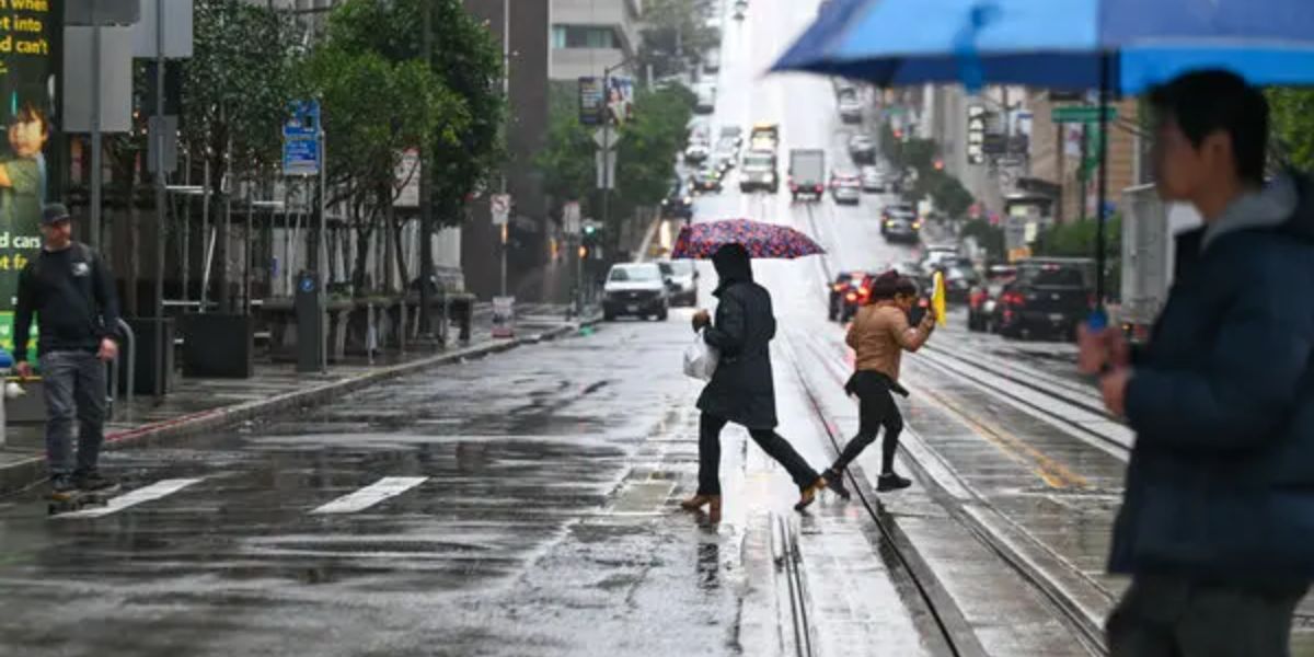
A 138-year-old record that had been in place since 1887 was broken Tuesday when 2.89 inches of rain fell on downtown San Francisco.
In addition to bringing destructive winds, the multiday atmospheric river felled a large area of trees surrounding a Santa Rosa, California, elementary school. According to the Santa Rosa Fire Department, nobody was harmed.
North of San Francisco, the coast recorded the greatest winds, with one gusting to 90 mph.
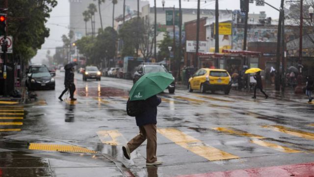
Beneficial rain will enter the southern region of the state, which is currently experiencing wildfires, on Wednesday when the current atmospheric river tapers off.
Dozens of Musicians Contribute to L.A. Fire Benefit Album, Available for One Day Only
Rainfall in Southern California could bring the fire season to a close
The next two rounds of rain could finish this horrific wildfire season for Southern California and Los Angeles, as the devastating fires across the region have finally been contained.
The heaviest rain is expected to remain west of the main burn scars as the first bout of moderate rain starts Wednesday morning.
It is anticipated that the rain will be moderate enough to lessen the likelihood of debris flows and mudslides.
Similar amounts of rain are predicted to resume on Thursday afternoon and Friday morning.
For the area, which has been suffering from rain deficits of 5–10 inches since October, the rain is a very good first step toward ending the fire weather season, but it is not quite enough.
Northern California will see its third round of rain and snow on Thursday
Beginning Thursday, just before the start of the morning commute, the atmospheric river is predicted to return for Northern California and the Pacific Northwest.
It is predicted that this storm will bring moderate to heavy rainfall. The majority of the California coast, from San Francisco to just north of Los Angeles, is under a Level 1 out of 5 flash flood hazard from Thursday into Friday. The similar risk of flash floods exists in Northern California’s interior.
This last image of the atmospheric river, however, will flow swiftly and avoid significant flood risks or significant snow accumulations.
Snow will fall on the Western Mountains in feet
Due to this final discharge from the atmospheric river, a significant portion of Oregon, along with Idaho and Montana, have been under a winter storm warning into Friday AM.
In California, feet of snow are predicted for the eastern slopes of the Sierra Madre range.
From Thursday morning through Friday, extremely bad travel conditions are predicted in the Sierra Nevada.